Lima Jorge Chavez International Airport (LIM)
Orientation and Maps
(Lima, Peru)
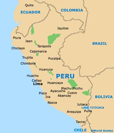
The biggest city in the whole of the country, Lima is Peru's capital and an important city of finance and culture. Located on the western coastline, Lima is known for its valleys and winding rivers, which include the Lurin River and Rimac River.
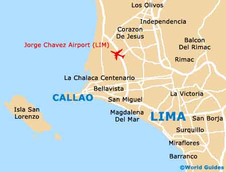
Standing on the city's north-western outskirts, Lima Callao Jorge Chavez International Airport (LIM) is an important transport hub for Peru and the spreading Lima Metropolitan Area. Much of the terrain around the city is fairly flat, sloping gently towards the coastline of the Pacific Ocean.
Lima Callao Jorge Chavez International Airport (LIM) Maps: Important City Districts
Within Lima itself there are around 30 different districts and neighbourhoods, with the city being part of the Lima province. Many of the attractions in the city are based around the Cercado de Lima district, which is where the main downtown area is situated. Downtown Lima is famous for its Spanish architecture and interconnecting streets, which radiate out from the Plaza de Armas. Highlights in the downtown district include the cathedral, the Palacio de Gobierno and the Plaza San Martin, where a host of popular shops and restaurants can be found.
Just a few miles to the south of downtown Lima, Miraflores is where you will find many of the best hotels and restaurants, together with the nearby district of San Isidro, which is known for its large parklands. Other notable neighbourhoods on the outskirts of Lima include Monterrico, Pueblo Libre and San Borja.
Peru Map
Lima Map